Tinkham Realty, Inc.
3 McAllister Drive
Londonderry, NH 03053
(603) 432-7769
(603) 434-1545 Fax
info@tinkhamrealty.com
|
Hooksett, NH Town Profile
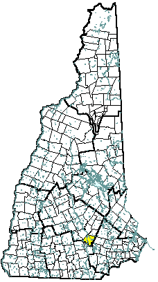 |
| Hooksett, NH |
| Community Contact |
Town of Hooksett
David Jodoin, Town Administrator
16 Main Street, Hooksett Municipal Building
Hooksett, NH 03106-1397
|
| Telephone |
(603) 485-8472 |
| Fax |
(603) 485-4423 |
| E-mail |
djodoin@hooksett.org |
| Web Site |
www.hooksett.org
|
| Municipal Office Hours |
Monday through Friday, 8 am - 4:30 pm; Tax Collector: Monday through Friday, 8 am - 4:30 pm, and extended hours on Wednesday until 6:30 pm
|
| County |
Merrimack |
| Labor Market Area |
Manchester NH Metro-NECTA |
| Tourism Region |
Merrimack Valley |
| Planning Commission |
Southern NH |
| Regional Development |
Capital Regional Development Council
|
| Election Districts |
|
|
US Congress
|
District 1 |
|
Executive Council
|
District 4 |
|
State Senate
|
District 16 |
|
State Representative
|
Merrimack County District 9 |
|
Incorporated: 1822
|
Origin: First known as Chester Woods and Rowe's Corner, this town was called Hooksett for nearly fifty years before being incorporated. The name may have come from a hook-shaped island in the Merrimack or from early fishermen, who called the area Hookline Falls. It was also known as Isle au Hooksett and Isle au Hooksett Falls. Rocky ledges flank the Merrimack River as it passes through, and there were cross-river ferries located here, as well as lumber mills and a brick-making establishment powered by the falls. In 1794, the lottery-funded Hooksett Canal became part of the transportation facilities of the Amoskeag cotton mills in Manchester.
|
Villages and Place Names: Martin, Martins Corner, Rowes Corner, South Hooksett, Martins Ferry
|
Population, Year of the First Census Taken: 880 residents in 1830
|
Population Trends: Population change for Hooksett totaled 8,992 over 50 years, from 2,792 in 1950 to 11,784 in 2000. The largest decennial percent change was a 50 percent increase between 1960 and 1970; the percent change was at least 30 percent in all but one other decade. The 2006 Census estimate for Hooksett was 13,439 residents, which ranked 19th among New Hampshire's incorporated cities and towns.
|
Population Density, 2006: 371.3 persons per square mile of land area. Hooksett contains 36.2 square miles of land area and 0.9 square miles of inland water area.
|
| Type of Government |
Administrator & Council |
| Budget: Municipal Appropriations, 2007/08 |
$15,010,889 |
| Budget: School Appropriations |
not available |
| Zoning Ordinance |
1957/06 |
| Master Plan |
2005 |
| Capitol Improvement Plan |
Yes |
| Industrial Plans Reviewed By |
Engineering Consultant |
| Boards and Commissions |
|
Elected:
|
Town Council; Budget; Cemetery; Library; Moderator; Sewer; Checklist; Trust Funds |
|
Appointed:
|
Planning; Zoning; Conservation; Building; Heritage; Parks & Rec; Police; Solid Waste |
| Public Library |
Hooksett Public |
| Police Department |
Full-time |
| Fire Department |
Full-time |
| Town Fire Insurance Rating |
4/9 |
| Emergency Medical Service |
Municipal & private |
| Nearest Hospital(s) |
Distance |
Staffed Beds |
| Elliot Hospital, Manchester |
8 miles |
296 |
| Catholic Medical Center, Manchester |
8 miles |
330 |
| |
|
|
| Electric Supplier |
PSNH |
| Natural Gas Supplier |
KeySpan |
| Water Supplier |
Central Water; Hooksett Village Water Precinct |
| Sanitation |
Municipal |
| Municipal Wastewater Treatment Plant |
Yes |
| Solid Waste Disposal |
|
|
Curbside Trash Pickup
|
Municipal |
|
Pay-As-You-Throw Program
|
No |
|
Recycling
|
Voluntary |
| Telephone Company |
Verizon |
| Cellular Telephone Access |
Yes |
| Cable Television Access |
Yes |
| Public Access Television Station |
No |
| High Speed Internet Service: |
|
|
Business
|
Limited |
|
Residential
|
Limited |
|
|
| 2006 Total Tax Rate (per $1000 of value) |
$22.68 |
| 2006 Equalization Ratio |
83.7 |
| 2006 Full Value Tax Rate (per $1000 of value) |
$18.60 |
| 2006 Percent of Local Assessed Value by Property Type |
|
Residential Land and Buildings
|
73.8% |
|
Commercial Land and Buildings
|
23.0% |
|
Public Utilities, Current Use, and Other
|
3.2% |
|
|
| 2006 Total Housing Units |
5,018 |
| |
|
| 2006 Single-Family Units |
3,181 |
|
Single-Family Permits Issued, Net Change of Units
|
40 |
| 2006 Multi-Family Units |
1,506 |
|
Multi-Family Permits Issued, Net Change of Units
|
8 |
| 2006 Manufactured Housing Units |
331 |
|
|
 |
|
|
|
| Total Population |
Community |
County |
| 2006 |
13,439 |
148,085 |
| 2000 |
11,784 |
136,716 |
| 1990 |
9,034 |
120,618 |
| 1980 |
7,303 |
98,302 |
| 1970 |
5,564 |
80,925 |
| Census 2000 Demographics |
| Population by Gender |
|
Male
|
5,858 |
Female
|
5,863 |
| Population by Age Group |
|
Under age 5
|
764 |
|
Age 5 to 19
|
2,657 |
|
Age 20 to 34
|
2,372 |
|
Age 35 to 54
|
3,917 |
|
Age 55 to 64
|
949 |
|
Age 65 and over
|
1,062 |
|
Median Age
|
35.3 years |
| Educational Attainment, population 25 years and over |
|
High school graduate or higher
|
88.6% |
|
Bachelor's degree or higher
|
29.4% |
|
|
| Per capita income |
$24,629 |
| Median 4-person family income |
$68,673 |
| Median household income |
$61,491 |
| Median Earnings, full-time, year-round workers |
|
Male
|
$43,524 |
|
Female
|
$31,341 |
| Families below the poverty level |
3.2% |
|
|
| Annual Average |
1996 |
2006 |
|
Civilian Labor Force
|
5,298 |
7,830 |
|
Employed
|
5,144 |
7,583 |
|
Unemployed
|
154 |
247 |
|
Unemployment Rate
|
2.9% |
3.2% |
|
|
| Annual Average Covered Employment |
1996 |
2006 |
| Goods Producing Industries |
|
|
|
Average Employment
|
1,851 |
1,890 |
|
Average Weekly Wage
|
$681 |
$1,114 |
| |
|
|
| Service Providing Industries |
|
|
|
Average Employment
|
3,384 |
5,554 |
|
Average Weekly Wage
|
$501 |
$712 |
| |
|
|
| Total Private Industry |
|
|
|
Average Employment
|
5,235 |
7,444 |
|
Average Weekly Wage
|
$564 |
$814 |
| |
|
|
| Government (Federal, State, and Local) |
|
|
|
Average Employment
|
486 |
590 |
|
Average Weekly Wage
|
$451 |
$661 |
| |
|
|
| Total, Private plus Government |
|
|
|
Average Employment
|
5,721 |
8,034 |
|
Average Weekly Wage
|
$555 |
$803 |
| n = indicates that the data does not meet disclosure standards |
|
| Schools students attend: |
Hooksett operates grades K-8; grades 9-12 are tuitioned to Manchester West or Manchester Central |
District: SAU 15 |
| Career Technology Center(s): |
Manchester School of Technology |
Region: 15 |
|
| |
| Educational Facilities |
Elementary |
Middle/Junior High |
High School |
Private/Parochial |
|
Number of Schools
|
2 |
1 |
|
2 |
|
Grade Levels
|
P K 1-5 |
6-8 |
|
P K 1-10 |
|
Total Enrollment
|
984 |
537 |
|
18 |
|
| NH Licensed Child Care Facilities, 2007: |
Total Facilities: 17 |
Total Capacity: 838 |
|
| Nearest Community/Technical College: Concord; Manchester |
| Nearest Colleges or Universities: Southern NH University; Hesser; St. Anselm; UNH-Manchester |
|
| General Electric Co. |
Jet engine parts |
800 |
1966 |
| Southern NH University |
Education |
700 |
1972 |
| Granite State Marketplace |
Strip mall |
443 |
1988 |
| Oxford Health |
Health insurance |
400 |
1995 |
| Hooksett Plaza |
Retail |
167 |
1974 |
| Poultry Products Co, Inc |
Poultry parts |
160 |
1978 |
| Wal-Mart |
Department store |
160 |
1991 |
| Pro Con Inc. |
Construction |
153 |
1980 |
| Cummings Printing |
Printing |
150 |
1993 |
| Merchants Automotive Group |
Car rentals, sales |
150 |
1962 |
| Road Access |
US Routes |
3 |
| |
State Routes |
3A, 28, 28 Bypass |
| Nearest Interstate, Exit |
I-93, Exits 9 - 11 |
| |
Distance |
Local access |
| Railroad |
Guilford Transportation |
| Public Transportation |
No |
| |
| Nearest Public Use Airport, General Aviation |
|
Manchester-Boston Regional
|
|
Runway
|
9,250 ft. asphalt |
|
Lighted?
|
Yes |
Navigational Aids? |
Yes |
| Nearest Airport with Scheduled Service |
| Manchester-Boston Regional |
Distance |
15 miles |
| Number of Passsenger Airlines Serving Airport |
8 |
| Driving distance to selected cities: |
|
Manchester, NH
|
9 miles |
|
Portland, ME
|
101 miles |
|
Boston, MA
|
59 miles |
|
New York City, NY
|
263 miles |
|
Montreal, Quebec
|
252 miles |
| Workers 16 years and over |
|
|
Drove alone, car/truck/van
|
82.0% |
|
Carpooled, car/truck/van
|
8.8% |
|
Public transportation
|
1.6% |
|
Walked
|
3.6% |
|
Other Means
|
0.4% |
|
Worked at home
|
3.6% |
| Mean Travel Time to Work |
25.7 minutes |
| |
|
| Percent of Working Residents: |
|
|
Working in community of residence
|
21% |
|
Commuting to another NH community
|
71% |
|
Commuting out-of-state
|
8% |
|
|
|
|
| X |
Municipal Parks |
| |
YMCA/YWCA |
| |
Boys Club/Girls Club |
| X |
Golf Courses |
| |
Swimming: Indoor Facility |
| X |
Swimming: Outdoor Facility |
| |
Tennis Courts: Indoor Faclity |
| X |
Tennis Courts: Outdoor Facility |
| X |
Ice Skating Rink: Indoor Facility |
| |
Bowling Facilities |
| |
Museums |
| X |
Cinemas |
| |
Performing Arts Facilities |
| |
Tourists Attractions |
| X |
Youth Organizations (i.e., Scouts, 4-H) |
| X |
Youth Sports: Baseball |
| X |
Youth Sports: Soccer |
| X |
Youth Sports: Football |
| X |
Youth Sports: Basketball |
| X |
Youth Sports: Hockey |
| X |
Campgrounds |
| X |
Fishing/Hunting |
| X |
Boating/Marinas |
| |
Snowmobile Trails |
| X |
Bicycle Trails |
| |
Cross Country Skiing |
| X |
Beach or Waterfront Recreational Area |
| |
Overnight or Day Camps |
| |
|
| |
Nearest Ski Area(s): McIntyre |
| |
|
| |
Other: |
|
Economic & Labor Market Information Bureau, NH Employment Security, 2007. Community Response Received 08/10/07
|
|