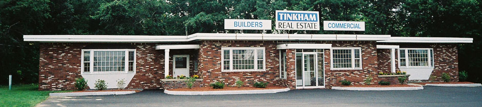
Tinkham Realty, Inc.
3 McAllister Drive
Londonderry, NH 03053
(603) 432-7769
(603) 434-1545 Fax
info@tinkhamrealty.com
|
Manchester, NH Town Profile
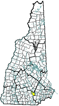 |
| Manchester, NH |
| Community Contact |
Manchester Economic Development Office
Jay Minkarah, Economic Development Director
One City Hall Plaza, Suite 110
Manchester, NH 03101-2099
|
| Telephone |
(603) 624-6505 |
| Fax |
(603) 624-6308 |
| E-mail |
econdev@manchesternh.gov |
| Web Site |
www.ManchesterNH.gov
|
| Municipal Office Hours |
Monday through Friday, 8 am - 5 pm
|
| County |
Hillsborough |
| Labor Market Area |
Manchester NH Metro-NECTA |
| Tourism Region |
Merrimack Valley |
| Planning Commission |
Southern NH |
| Regional Development |
Southeast Economic Development Corp.
|
| Election Districts |
|
|
US Congress
|
District 1 (All Wards) |
|
Executive Council
|
District 4 (All Wards) |
|
State Senate
|
District 16 (Wards 1, 2, & 12), 18 (Wards 5-9), and 20 (Wards 3, 4, 10, & 11) |
|
State Representative
|
Hillsborough County Districts 8 (Ward 1), 9 (Ward 2), 10 (Ward 3), 11 (Ward 4), 12 (Ward 5), 13 (Ward 6), 14 (Ward 7), 15 (Ward 8) 16 (Ward 9), and 17 (Wards 10, 11, & 12) |
|
Incorporated: 1751
|
Origin: This territory, first known as Harrytown, was granted in 1735 as Tyng's Town to Captain William Tyng's snow-shoe men who had fought in the French and Indian War during the winter of 1703. In 1751, it was incorporated as Derryfield, and included part of Chester and Londonderry. The name Manchester was suggested by Samuel Blodgett, a businessman who found that the Amoskeag Falls impeded shipping on the Merrimack River. He had visited Manchester, England, and was determined to build a canal like those in England. The canal was opened in May 1807, and though Mr. Blodgett died later that year, the town was renamed Manchester in 1810. The first cotton spinning mill opened in 1804, and the Amoskeag Cotton and Wool Manufacturing Company opened in 1810. Manchester was incorporated as a city in 1846.
|
Villages and Place Names: Goffs Falls, Massabesic, Youngsville, Bakersville, Amoskeag
|
Population, Year of the First Census Taken: 362 residents in 1790
|
Population Trends: The state's largest city, population change for Manchester was the third largest, totaling 24,487 over 50 years, from 82,732 in 1950 to 107,219 in 2000. The largest decennial percent change was just nine percent, between 1980 and 1990. The 2006 Census estimate for Manchester was 109,497 residents, which ranked first among New Hampshire's incorporated cities and towns.
|
Population Density, 2006: 3,314.1 persons per square mile of land area, the state's highest population density. Manchester contains 33.0 square miles of land area and 1.9 square miles of inland water area.
|
| Type of Government |
Mayor & 14 Aldermen |
| Budget: Municipal Appropriations, 2007 |
$117,561,960 |
| Budget: School Appropriations, 2007 |
$145,500,000 |
| Zoning Ordinance |
1927/01 |
| Master Plan |
1993 |
| Capitol Improvement Plan |
Yes |
| Industrial Plans Reviewed By |
City Planning Board |
| Boards and Commissions |
|
Elected:
|
Mayor; Aldermen |
|
Appointed:
|
Planning; Conservation; Library; 25 others |
| Public Library |
Manchester City; West Side Community |
| Police Department |
Full-time |
| Fire Department |
Full-time |
| Town Fire Insurance Rating |
2 |
| Emergency Medical Service |
Municipal |
| Nearest Hospital(s) |
Distance |
Staffed Beds |
| Elliot Hospital, Manchester |
Local |
296 |
| Catholic Medical Center, Manchester |
Local |
330 |
| |
|
|
| Electric Supplier |
PSNH |
| Natural Gas Supplier |
KeySpan |
| Water Supplier |
Manchester Water Works |
| Sanitation |
Municipal |
| Municipal Wastewater Treatment Plant |
Yes |
| Solid Waste Disposal |
|
|
Curbside Trash Pickup
|
Municipal |
|
Pay-As-You-Throw Program
|
No |
|
Recycling
|
Yard waste-Mandatory; Recyclables-Voluntary |
| Telephone Company |
Verizon |
| Cellular Telephone Access |
Yes |
| Cable Television Access |
Yes |
| Public Access Television Station |
Yes |
| High Speed Internet Service: |
|
|
Business
|
Yes |
|
Residential
|
Yes |
|
|
| 2006 Total Tax Rate (per $1000 of value) |
$16.85 |
| 2006 Equalization Ratio |
95.9 |
| 2006 Full Value Tax Rate (per $1000 of value) |
$15.65 |
| 2006 Percent of Local Assessed Value by Property Type |
|
Residential Land and Buildings
|
63.9% |
|
Commercial Land and Buildings
|
34.6% |
|
Public Utilities, Current Use, and Other
|
1.5% |
|
|
| 2006 Total Housing Units |
48,445 |
| |
|
| 2006 Single-Family Units |
17,921 |
|
Single-Family Permits Issued, Net Change of Units
|
54 |
| 2006 Multi-Family Units |
30,363 |
|
Multi-Family Permits Issued, Net Change of Units
|
159 |
| 2006 Manufactured Housing Units |
161 |
|
|
 |
|
|
|
| Total Population |
Community |
County |
| 2006 |
109,497 |
402,789 |
| 2000 |
107,219 |
382,384 |
| 1990 |
99,426 |
336,549 |
| 1980 |
90,936 |
276,608 |
| 1970 |
87,754 |
223,941 |
| Census 2000 Demographics |
| Population by Gender |
|
Male
|
52,394 |
Female
|
54,612 |
| Population by Age Group |
|
Under age 5
|
7,162 |
|
Age 5 to 19
|
20,928 |
|
Age 20 to 34
|
25,525 |
|
Age 35 to 54
|
31,468 |
|
Age 55 to 64
|
8,094 |
|
Age 65 and over
|
13,829 |
|
Median Age
|
34.9 years |
| Educational Attainment, population 25 years and over |
|
High school graduate or higher
|
80.7% |
|
Bachelor's degree or higher
|
22.3% |
|
|
| Per capita income |
$21,244 |
| Median 4-person family income |
$50,039 |
| Median household income |
$40,774 |
| Median Earnings, full-time, year-round workers |
|
Male
|
$34,287 |
|
Female
|
$26,584 |
| Families below the poverty level |
7.7% |
|
|
| Annual Average |
1996 |
2006 |
|
Civilian Labor Force
|
54,748 |
61,846 |
|
Employed
|
52,888 |
59,457 |
|
Unemployed
|
1,860 |
2,389 |
|
Unemployment Rate
|
3.4% |
3.9% |
|
|
| Annual Average Covered Employment |
1996 |
2006 |
| Goods Producing Industries |
|
|
|
Average Employment
|
11,115 |
9,362 |
|
Average Weekly Wage
|
$634 |
$948 |
| |
|
|
| Service Providing Industries |
|
|
|
Average Employment
|
43,017 |
50,080 |
|
Average Weekly Wage
|
$544 |
$822 |
| |
|
|
| Total Private Industry |
|
|
|
Average Employment
|
54,132 |
59,442 |
|
Average Weekly Wage
|
$562 |
$842 |
| |
|
|
| Government (Federal, State, and Local) |
|
|
|
Average Employment
|
6,980 |
7,514 |
|
Average Weekly Wage
|
$668 |
$915 |
| |
|
|
| Total, Private plus Government |
|
|
|
Average Employment
|
61,113 |
66,956 |
|
Average Weekly Wage
|
$574 |
$850 |
| n = indicates that the data does not meet disclosure standards |
|
| Schools students attend: |
Manchester operates grades K-12 |
District: SAU 37 |
| Career Technology Center(s): |
Manchester School of Technology |
Region: 15 |
|
| |
| Educational Facilities |
Elementary |
Middle/Junior High |
High School |
Private/Parochial |
|
Number of Schools
|
15 |
4 |
3 |
12 |
|
Grade Levels
|
P K R 1-5 |
6-8 |
9-12 |
K 1-12 |
|
Total Enrollment
|
6,897 |
3,469 |
6,788 |
2,451 |
|
| NH Licensed Child Care Facilities, 2007: |
Total Facilities: 70 |
Total Capacity: 4,563 |
|
| Nearest Community/Technical College: Manchester |
| Nearest Colleges or Universities: Hesser; St. Anselm; Southern NH University; UNH-Manchester |
|
| Elliott Hospital |
Health care |
2,821 |
|
| Catholic Medical Center |
Health care |
1,700 |
|
| Verizon |
Utility |
1,650 |
|
| PSNH |
Utility |
1,250 |
|
| Citizens Bank |
Banking |
1,225 |
|
| TD Banknorth |
Banking |
1,150 |
|
| Anthem Blue Cross Blue Shield of NH |
Insurance |
753 |
|
| Southern NH University |
College |
700 |
|
| Osram Sylvania |
Electronics |
650 |
|
| Freudenberg NOK |
Electronics |
560 |
|
| Road Access |
US Routes |
3 |
| |
State Routes |
3A, 28, 28A 101, 114, 114A |
| Nearest Interstate, Exit |
I-93, Exits 6 - 8; I-293, Exits 1 - 7 |
| |
Distance |
Local access |
| Railroad |
Boston & Maine |
| Public Transportation |
Yes |
| |
| Nearest Public Use Airport, General Aviation |
|
Manchester-Boston Regional
|
|
Runway
|
9,250 ft. asphalt |
|
Lighted?
|
Yes |
Navigational Aids? |
Yes |
| Nearest Airport with Scheduled Service |
| Manchester-Boston Regional |
Distance |
Local |
| Number of Passsenger Airlines Serving Airport |
8 |
| Driving distance to selected cities: |
|
Manchester, NH
|
0 miles |
|
Portland, ME
|
95 miles |
|
Boston, MA
|
53 miles |
|
New York City, NY
|
252 miles |
|
Montreal, Quebec
|
259 miles |
| Workers 16 years and over |
|
|
Drove alone, car/truck/van
|
81.0% |
|
Carpooled, car/truck/van
|
11.9% |
|
Public transportation
|
1.4% |
|
Walked
|
2.9% |
|
Other Means
|
0.7% |
|
Worked at home
|
2.2% |
| Mean Travel Time to Work |
21.3 minutes |
| |
|
| Percent of Working Residents: |
|
|
Working in community of residence
|
52% |
|
Commuting to another NH community
|
41% |
|
Commuting out-of-state
|
7% |
|
|
|
|
| X |
Municipal Parks |
| X |
YMCA/YWCA |
| X |
Boys Club/Girls Club |
| X |
Golf Courses |
| X |
Swimming: Indoor Facility |
| X |
Swimming: Outdoor Facility |
| X |
Tennis Courts: Indoor Faclity |
| X |
Tennis Courts: Outdoor Facility |
| X |
Ice Skating Rink: Indoor Facility |
| X |
Bowling Facilities |
| X |
Museums |
| X |
Cinemas |
| X |
Performing Arts Facilities |
| X |
Tourists Attractions |
| X |
Youth Organizations (i.e., Scouts, 4-H) |
| X |
Youth Sports: Baseball |
| X |
Youth Sports: Soccer |
| X |
Youth Sports: Football |
| X |
Youth Sports: Basketball |
| X |
Youth Sports: Hockey |
| |
Campgrounds |
| X |
Fishing/Hunting |
| X |
Boating/Marinas |
| X |
Snowmobile Trails |
| X |
Bicycle Trails |
| X |
Cross Country Skiing |
| X |
Beach or Waterfront Recreational Area |
| |
Overnight or Day Camps |
| |
|
| |
Nearest Ski Area(s): McIntyre |
| |
|
| |
Other: Gill Stadium; Currier Gallery of Art; Amoskeag Fishways Learning Center; Verizon Wireless Arena; Palace Theatre; NH Fishercats Stadium |
|
Economic & Labor Market Information Bureau, NH Employment Security, 2007. Community Response Received 08/10/07
|
|