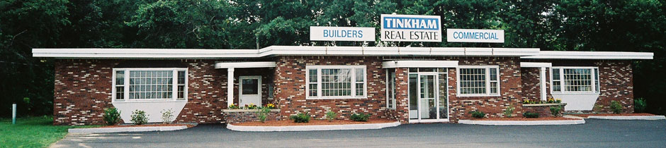
Tinkham Realty, Inc.
3 McAllister Drive
Londonderry, NH 03053
(603) 432-7769
(603) 434-1545 Fax
info@tinkhamrealty.com
|
Nashua, NH Town Profile
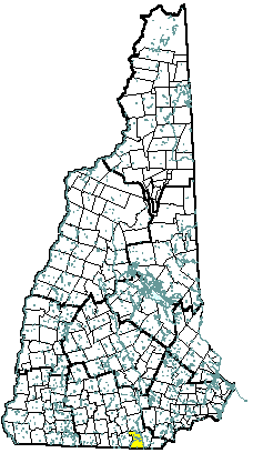 |
| Nashua, NH |
| Community Contact |
City of Nashua
Katherine Hersh, Community Development Director
229 Main Street, PO Box 2019
Nashua, NH 03061-2019
|
| Telephone |
(603) 589-3098 |
| Fax |
(603) 589-3119 |
| E-mail |
mayoroffice@ci.nashua.nh.us |
| Web Site |
www.nashuanh.gov
|
| Municipal Office Hours |
Monday through Friday, 8 am - 5 pm
|
| County |
Hillsborough |
| Labor Market Area |
Nashua NH-MA NECTA Division, NH Portion |
| Tourism Region |
Merrimack Valley |
| Planning Commission |
Nashua Regional |
| Regional Development |
Gateway Industrial Development Corp.
|
| Election Districts |
|
|
US Congress
|
District 2 (All Wards) |
|
Executive Council
|
District 5 (All Wards) |
|
State Senate
|
District 12 (Wards 1, 2, 5, & 9), and 13 (Wards 3, 4, 6, 7, & 8) |
|
State Representative
|
Hillsborough County Districts 20 (Ward 1), 21 (Ward 2), 22 (Ward 3), 23 (Ward 4), 24 (Ward 6), 25 (Ward 7), and 26 (Wards 5, 8, & 9) |
|
Incorporated: 1746
|
Origin: Originally part of a 1673 grant to Edward Tyng of Dunstable, England, the 200 square mile area, called Dunstable, included Nashua, Tyngsboro MA, and all or part of ten other towns. In 1741, Dunstable was cut in half when the Massachusetts-New Hampshire border was established. The northern half kept the name Dunstable. In 1836 the town took the Nashua River's name, a Nashaway Indian word for "beautiful river with a pebbly bottom" and "land between two rivers." In 1842, the town was divided again, with the section north of the Nashua River incorporated as Nashville. The two sections rejoined when Nashua was incorporated as a city in 1853. Nashua became a manufacturing center, powered by the Middlesex Canal which connected the Merrimack River to Boston.
|
Villages and Place Names: Nashville Historic District, French Hill, Crown Hill, North End.
|
Population, Year of the First Census Taken: 632 residents in 1790
|
Population Trends: Nashua ranked first in numeric population change, totaling 52,113 over 50 years, from 34,669 in 1950 to 86,782 in 2000. The largest decennial percent change was 43 percent between 1960 and 1970; the smallest, nine percent between 1990 and 2000. The 2006 Census estimate for Nashua was 87,157 residents, which ranked second among New Hampshire's incorporated cities and towns.
|
Population Density, 2006: 2,834.4 persons per square mile of land area, the second highest among the cities and towns. Nashua contains 30.8 square miles of land area and 1.0 square miles of inland water area.
|
| Type of Government |
Mayor & Council |
| Budget: Municipal Appropriations, 2007 |
$215,735,815 |
| Budget: School Appropriations, 2007 |
$80,791,428 |
| Zoning Ordinance |
1930/06 |
| Master Plan |
2002 |
| Capitol Improvement Plan |
Yes |
| Industrial Plans Reviewed By |
Planning Board |
| Boards and Commissions |
|
Elected:
|
Aldermen; School; Public Works; Fire |
|
Appointed:
|
Planning; Conservation; Library; Cemetery; Zoning; Business & Industrial Development; Housing Authority |
| Public Library |
Nashua Public |
| Police Department |
Full-time |
| Fire Department |
Full-time |
| Town Fire Insurance Rating |
2 |
| Emergency Medical Service |
Municipal |
| Nearest Hospital(s) |
Distance |
Staffed Beds |
| Southern NH Medical Center, Nashua |
Local |
188 |
| St. Joseph Hospital, Nashua |
Local |
208 |
| |
|
|
| Electric Supplier |
PSNH |
| Natural Gas Supplier |
KeySpan |
| Water Supplier |
Pennichuck Water Works |
| Sanitation |
Municipal |
| Municipal Wastewater Treatment Plant |
Yes |
| Solid Waste Disposal |
|
|
Curbside Trash Pickup
|
Municipal |
|
Pay-As-You-Throw Program
|
No |
|
Recycling
|
Voluntary Curbside |
| Telephone Company |
Verizon |
| Cellular Telephone Access |
Yes |
| Cable Television Access |
Yes |
| Public Access Television Station |
Yes |
| High Speed Internet Service: |
|
|
Business
|
Yes |
|
Residential
|
Yes |
|
|
| 2006 Total Tax Rate (per $1000 of value) |
$17.20 |
| 2006 Equalization Ratio |
95.2 |
| 2006 Full Value Tax Rate (per $1000 of value) |
$16.20 |
| 2006 Percent of Local Assessed Value by Property Type |
|
Residential Land and Buildings
|
69.8% |
|
Commercial Land and Buildings
|
28.4% |
|
Public Utilities, Current Use, and Other
|
1.9% |
|
|
| 2006 Total Housing Units |
36,735 |
| |
|
| 2006 Single-Family Units |
16,812 |
|
Single-Family Permits Issued, Net Change of Units
|
81 |
| 2006 Multi-Family Units |
19,033 |
|
Multi-Family Permits Issued, Net Change of Units
|
67 |
| 2006 Manufactured Housing Units |
890 |
|
|
 |
|
|
|
| Total Population |
Community |
County |
| 2006 |
87,157 |
402,789 |
| 2000 |
86,782 |
382,384 |
| 1990 |
79,937 |
336,549 |
| 1980 |
67,865 |
276,608 |
| 1970 |
55,820 |
223,941 |
| Census 2000 Demographics |
| Population by Gender |
|
Male
|
42,775 |
Female
|
43,830 |
| Population by Age Group |
|
Under age 5
|
5,644 |
|
Age 5 to 19
|
17,735 |
|
Age 20 to 34
|
18,734 |
|
Age 35 to 54
|
27,055 |
|
Age 55 to 64
|
7,395 |
|
Age 65 and over
|
10,042 |
|
Median Age
|
35.8 years |
| Educational Attainment, population 25 years and over |
|
High school graduate or higher
|
86.6% |
|
Bachelor's degree or higher
|
31.5% |
|
|
| Per capita income |
$25,209 |
| Median 4-person family income |
$61,102 |
| Median household income |
$51,969 |
| Median Earnings, full-time, year-round workers |
|
Male
|
$43,893 |
|
Female
|
$29,171 |
| Families below the poverty level |
5.0% |
|
|
| Annual Average |
1996 |
2006 |
|
Civilian Labor Force
|
45,430 |
49,816 |
|
Employed
|
43,654 |
47,880 |
|
Unemployed
|
1,776 |
1,936 |
|
Unemployment Rate
|
3.9% |
3.9% |
|
|
| Annual Average Covered Employment |
1996 |
2006 |
| Goods Producing Industries |
|
|
|
Average Employment
|
12,804 |
9,869 |
|
Average Weekly Wage
|
$908 |
$1,539 |
| |
|
|
| Service Providing Industries |
|
|
|
Average Employment
|
32,126 |
37,295 |
|
Average Weekly Wage
|
$488 |
$756 |
| |
|
|
| Total Private Industry |
|
|
|
Average Employment
|
44,930 |
47,165 |
|
Average Weekly Wage
|
$608 |
$919 |
| |
|
|
| Government (Federal, State, and Local) |
|
|
|
Average Employment
|
3,779 |
4,516 |
|
Average Weekly Wage
|
$720 |
$1,047 |
| |
|
|
| Total, Private plus Government |
|
|
|
Average Employment
|
48,709 |
51,681 |
|
Average Weekly Wage
|
$617 |
$931 |
| n = indicates that the data does not meet disclosure standards |
|
| Schools students attend: |
Nashua operates grades K-12 |
District: SAU 42 |
| Career Technology Center(s): |
Wilbur Palmer Voc. Tech. Center, Hudson; Milford HS; Nashua HS North |
Region: 16 |
|
| |
| Educational Facilities |
Elementary |
Middle/Junior High |
High School |
Private/Parochial |
|
Number of Schools
|
12 |
4 |
3 |
10 |
|
Grade Levels
|
P K 1-5 |
6-8 |
9-12 |
K 1-12 |
|
Total Enrollment
|
5,378 |
3,076 |
4,258 |
2482 |
|
| NH Licensed Child Care Facilities, 2007: |
Total Facilities: 65 |
Total Capacity: 4,180 |
|
| Nearest Community/Technical College: Nashua |
| Nearest Colleges or Universities: Daniel Webster; Rivier; Thomas More |
|
| BAE Systems North America |
Tactical communications/surveillance |
4,000+ |
|
| City of Nashua |
Municipal services |
1,000+ |
|
| Southern NH Medical Center |
Health care |
1,000+ |
|
| St. Joseph Hospital & Trauma Center |
Health care |
1,000+ |
|
| Hewlett-Packard |
Computer software |
500+/- |
|
| Oxford Health Plans |
Health insurance plan provider |
500+/- |
|
| Oracle Corporation |
Software services provider |
250+ |
|
| Skillsoft |
Internet-based training courses & software |
250+ |
|
| |
|
|
|
| |
|
|
|
| Road Access |
US Routes |
3 |
| |
State Routes |
101A, 111, 111A, 130, 101A Bypass |
| Nearest Interstate, Exit |
Everett Tpk., Exits 1 - 8; I-93, Exit 3 |
| |
Distance |
Local access; 11 miles |
| Railroad |
Boston & Maine |
| Public Transportation |
Yes |
| |
| Nearest Public Use Airport, General Aviation |
|
Boire Field, Nashua
|
|
Runway
|
5,501 ft. asphalt |
|
Lighted?
|
Yes |
Navigational Aids? |
Yes |
| Nearest Airport with Scheduled Service |
| Manchester-Boston Regional |
Distance |
18 miles |
| Number of Passsenger Airlines Serving Airport |
8 |
| Driving distance to selected cities: |
|
Manchester, NH
|
18 miles |
|
Portland, ME
|
106 miles |
|
Boston, MA
|
43 miles |
|
New York City, NY
|
234 miles |
|
Montreal, Quebec
|
276 miles |
| Workers 16 years and over |
|
|
Drove alone, car/truck/van
|
83.5% |
|
Carpooled, car/truck/van
|
9.2% |
|
Public transportation
|
1.5% |
|
Walked
|
2.5% |
|
Other Means
|
0.7% |
|
Worked at home
|
2.7% |
| Mean Travel Time to Work |
24.7 minutes |
| |
|
| Percent of Working Residents: |
|
|
Working in community of residence
|
47% |
|
Commuting to another NH community
|
26% |
|
Commuting out-of-state
|
26% |
|
|
|
|
| X |
Municipal Parks |
| X |
YMCA/YWCA |
| X |
Boys Club/Girls Club |
| X |
Golf Courses |
| X |
Swimming: Indoor Facility |
| X |
Swimming: Outdoor Facility |
| X |
Tennis Courts: Indoor Faclity |
| X |
Tennis Courts: Outdoor Facility |
| X |
Ice Skating Rink: Indoor Facility |
| X |
Bowling Facilities |
| X |
Museums |
| X |
Cinemas |
| X |
Performing Arts Facilities |
| X |
Tourists Attractions |
| X |
Youth Organizations (i.e., Scouts, 4-H) |
| X |
Youth Sports: Baseball |
| X |
Youth Sports: Soccer |
| X |
Youth Sports: Football |
| X |
Youth Sports: Basketball |
| X |
Youth Sports: Hockey |
| |
Campgrounds |
| X |
Fishing/Hunting |
| X |
Boating/Marinas |
| |
Snowmobile Trails |
| X |
Bicycle Trails |
| |
Cross Country Skiing |
| |
Beach or Waterfront Recreational Area |
| |
Overnight or Day Camps |
| |
|
| |
Nearest Ski Area(s): Pat's Peak |
| |
|
| |
Other: Holiday Stroll; Summer Fun Series; Indoor Rock Climbing; Indoor Sky Jumping |
|
Economic & Labor Market Information Bureau, NH Employment Security, 2007. Community Response Received 08/22/07
|
|