Tinkham Realty, Inc.
3 McAllister Drive
Londonderry, NH 03053
(603) 432-7769
(603) 434-1545 Fax
info@tinkhamrealty.com
|
Sandown, NH Town Profile
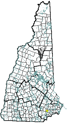 |
| Sandown, NH |
| Community Contact |
Sandown Board of Selectmen
Ted Winglass, Chairman
320 Main Street, PO Box 1756
Sandown, NH 03873
|
| Telephone |
(603) 887-3646 |
| Fax |
(603) 887-5163 |
| E-mail |
townofsandown@comcast.net |
| Web Site |
www.sandown.us/
|
| Municipal Office Hours |
Selectmen: Monday through Thursday, 8:30 am - 12 noon, 12:30 pm - 3 pm, Friday, 8:30 am - 12 noon; Town Clerk: Monday, 8 am - 12 noon, 2 pm - 8 pm, Tuesday and Thursday, 8 am - 12 noon, 12:30 pm - 3 pm, and Friday 8 am - 12 noon
|
| County |
Rockingham |
| Labor Market Area |
Haverhill MA-NH NECTA Division, NH Portion |
| Tourism Region |
Seacoast |
| Planning Commission |
Rockingham |
| Regional Development |
Rockingham Economic Development Corp.
|
| Election Districts |
|
|
US Congress
|
District 1 |
|
Executive Council
|
District 3 |
|
State Senate
|
District 17 |
|
State Representative
|
Rockingham County District 7 |
|
Incorporated: 1756
|
Origin: This territory was part of the original Kingston grant of 1694. As the western portion of Kingston became more heavily populated, residents felt that they could support a meetinghouse of their own, and petitioned Governor Benning Wentworth for separation. Sandown was incorporated as a separate parish in 1756. It was named for picturesque Sandown on the Isle of Wight. The first minister of Sandown, Reverend Joseph Cotton, built the Sandown Church in 1773. The church had an eleven-foot high pulpit and marble columns supporting the gallery, and is an excellent example of early New England church architecture.
|
Villages and Place Names: unknown
|
Population, Year of the First Census Taken: 561 residents in 1790
|
Population Trends: Sandown had the third largest percent change, with the largest decennial percent change a 178 percent between 1970 and 1980; the population doubled in two other decades. Population change for Sandown was 4,856 over 50 years, from 315 in 1950 to 5,171 in 2000. The 2006 Census estimate for Sandown was 5,776 residents, which ranked 57th among New Hampshire's incorporated cities and towns.
|
Population Density, 2006: 413.2 persons per square mile of land area. Sandown contains 14.0 square miles of land area and 0.4 square miles of inland water area.
|
| Type of Government |
Selectmen |
| Budget: Municipal Appropriations, 2006 |
$2,763,858 |
| Budget: School Appropriations |
not available |
| Zoning Ordinance |
1956/06 |
| Master Plan |
2003 |
| Capitol Improvement Plan |
Yes |
| Industrial Plans Reviewed By |
Planning Board |
| Boards and Commissions |
|
Elected:
|
Selectmen; Planning; Budget; Library; Cemetery |
|
Appointed:
|
Conservation; Zoning; Cable; Recreation; Communication & Technology |
| Public Library |
Sandown Public |
| Police Department |
Full-time |
| Fire Department |
Full-time Chief & volunteer |
| Town Fire Insurance Rating |
9/10 |
| Emergency Medical Service |
Volunteer |
| Nearest Hospital(s) |
Distance |
Staffed Beds |
| Parkland Medical Center, Derry |
10 miles |
86 |
| |
|
|
| |
|
|
| Electric Supplier |
PSNH; NH Electric Coop |
| Natural Gas Supplier |
None |
| Water Supplier |
Private wells |
| Sanitation |
Private septic |
| Municipal Wastewater Treatment Plant |
No |
| Solid Waste Disposal |
|
|
Curbside Trash Pickup
|
None |
|
Pay-As-You-Throw Program
|
No |
|
Recycling
|
Voluntary |
| Telephone Company |
Verizon; Granite State |
| Cellular Telephone Access |
Yes |
| Cable Television Access |
Yes |
| Public Access Television Station |
Yes |
| High Speed Internet Service: |
|
|
Business
|
Yes |
|
Residential
|
Yes |
|
|
| 2006 Total Tax Rate (per $1000 of value) |
$24.58 |
| 2006 Equalization Ratio |
76.4 |
| 2006 Full Value Tax Rate (per $1000 of value) |
$18.64 |
| 2006 Percent of Local Assessed Value by Property Type |
|
Residential Land and Buildings
|
97.4% |
|
Commercial Land and Buildings
|
1.9% |
|
Public Utilities, Current Use, and Other
|
0.6% |
|
|
| 2006 Total Housing Units |
2,123 |
| |
|
| 2006 Single-Family Units |
1,795 |
|
Single-Family Permits Issued, Net Change of Units
|
23 |
| 2006 Multi-Family Units |
200 |
|
Multi-Family Permits Issued, Net Change of Units
|
0 |
| 2006 Manufactured Housing Units |
128 |
|
|
 |
|
|
|
| Total Population |
Community |
County |
| 2006 |
5,776 |
296,267 |
| 2000 |
5,171 |
278,748 |
| 1990 |
4,069 |
246,744 |
| 1980 |
2,057 |
190,345 |
| 1970 |
741 |
138,951 |
| Census 2000 Demographics |
| Population by Gender |
|
Male
|
2,635 |
Female
|
2,508 |
| Population by Age Group |
|
Under age 5
|
394 |
|
Age 5 to 19
|
1,348 |
|
Age 20 to 34
|
843 |
|
Age 35 to 54
|
1,992 |
|
Age 55 to 64
|
294 |
|
Age 65 and over
|
272 |
|
Median Age
|
34.8 years |
| Educational Attainment, population 25 years and over |
|
High school graduate or higher
|
91.7% |
|
Bachelor's degree or higher
|
21.6% |
|
|
| Per capita income |
$25,978 |
| Median 4-person family income |
$73,083 |
| Median household income |
$67,581 |
| Median Earnings, full-time, year-round workers |
|
Male
|
$49,012 |
|
Female
|
$29,773 |
| Families below the poverty level |
3.3% |
|
|
| Annual Average |
1996 |
2006 |
|
Civilian Labor Force
|
2,828 |
3,163 |
|
Employed
|
2,703 |
3,034 |
|
Unemployed
|
125 |
129 |
|
Unemployment Rate
|
4.4% |
4.1% |
|
|
| Annual Average Covered Employment |
1996 |
2006 |
| Goods Producing Industries |
|
|
|
Average Employment
|
35 |
n |
|
Average Weekly Wage
|
$474 |
n |
| |
|
|
| Service Providing Industries |
|
|
|
Average Employment
|
60 |
n |
|
Average Weekly Wage
|
$376 |
n |
| |
|
|
| Total Private Industry |
|
|
|
Average Employment
|
95 |
194 |
|
Average Weekly Wage
|
$412 |
$704 |
| |
|
|
| Government (Federal, State, and Local) |
|
|
|
Average Employment
|
47 |
59 |
|
Average Weekly Wage
|
$225 |
$464 |
| |
|
|
| Total, Private plus Government |
|
|
|
Average Employment
|
142 |
253 |
|
Average Weekly Wage
|
$350 |
$648 |
| n = indicates that the data does not meet disclosure standards |
|
| Schools students attend: |
Grades 1-12 are part of Timberlane Regional (Atkinson, Danville, Plaistow, Sandown) |
District: SAU 55 |
| Career Technology Center(s): |
Pinkerton Academy, Derry; Salem High School Vocational Center |
Region: 17 |
|
| |
| Educational Facilities |
Elementary |
Middle/Junior High |
High School |
Private/Parochial |
|
Number of Schools
|
2 |
|
|
|
|
Grade Levels
|
1-5 |
|
|
|
|
Total Enrollment
|
408 |
|
|
|
|
| NH Licensed Child Care Facilities, 2007: |
Total Facilities: 5 |
Total Capacity: 141 |
|
| Nearest Community/Technical College: Stratham; Manchester |
| Nearest Colleges or Universities: Chester College of New England; University of NH |
|
| White Oak Farm |
Cookie factory |
5-6 |
|
| Compliance Properties, LLC |
|
5 |
1999 |
| |
|
|
|
| |
|
|
|
| |
|
|
|
| |
|
|
|
| |
|
|
|
| |
|
|
|
| |
|
|
|
| |
|
|
|
| Road Access |
US Routes |
|
| |
State Routes |
121, 121A |
| Nearest Interstate, Exit |
I-93, Exit 4 |
| |
Distance |
10 miles |
| Railroad |
No |
| Public Transportation |
No |
| |
| Nearest Public Use Airport, General Aviation |
|
Manchester-Boston Regional
|
|
Runway
|
9,250 ft. asphalt |
|
Lighted?
|
Yes |
Navigational Aids? |
Yes |
| Nearest Airport with Scheduled Service |
| Manchester-Boston Regional |
Distance |
22 miles |
| Number of Passsenger Airlines Serving Airport |
8 |
| Driving distance to selected cities: |
|
Manchester, NH
|
20 miles |
|
Portland, ME
|
84 miles |
|
Boston, MA
|
49 miles |
|
New York City, NY
|
252 miles |
|
Montreal, Quebec
|
277 miles |
| Workers 16 years and over |
|
|
Drove alone, car/truck/van
|
86.9% |
|
Carpooled, car/truck/van
|
7.6% |
|
Public transportation
|
0.2% |
|
Walked
|
0.5% |
|
Other Means
|
1.2% |
|
Worked at home
|
3.7% |
| Mean Travel Time to Work |
34.4 minutes |
| |
|
| Percent of Working Residents: |
|
|
Working in community of residence
|
10% |
|
Commuting to another NH community
|
55% |
|
Commuting out-of-state
|
35% |
|
|
|
|
| X |
Municipal Parks |
| |
YMCA/YWCA |
| |
Boys Club/Girls Club |
| |
Golf Courses |
| |
Swimming: Indoor Facility |
| X |
Swimming: Outdoor Facility |
| |
Tennis Courts: Indoor Faclity |
| |
Tennis Courts: Outdoor Facility |
| |
Ice Skating Rink: Indoor Facility |
| |
Bowling Facilities |
| X |
Museums |
| |
Cinemas |
| |
Performing Arts Facilities |
| X |
Tourists Attractions |
| X |
Youth Organizations (i.e., Scouts, 4-H) |
| X |
Youth Sports: Baseball |
| X |
Youth Sports: Soccer |
| |
Youth Sports: Football |
| X |
Youth Sports: Basketball |
| |
Youth Sports: Hockey |
| X |
Campgrounds |
| X |
Fishing/Hunting |
| X |
Boating/Marinas |
| X |
Snowmobile Trails |
| X |
Bicycle Trails |
| X |
Cross Country Skiing |
| X |
Beach or Waterfront Recreational Area |
| |
Overnight or Day Camps |
| |
|
| |
Nearest Ski Area(s): Gunstock, Pat's Peak |
| |
|
| |
Other: Summer Recreation Program |
|
Economic & Labor Market Information Bureau, NH Employment Security, 2007. Community Response Received 08/09/07
|
|